Oltre Giuba (Italian Jubaland)
Map Issue of 1926
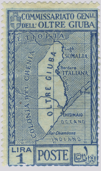
One of seven values in the set of "map
stamps" issued on April 21, 1926.
Oltre Giuba (Jubaland) was a strip of land 50 to 100 miles wide, west of the Juba River. The first stamps used in the area were those of British East Africa after the opening of Kismayu Post Office around 1896. The territory was ceded to Italy by Great Britain in 1924 to satisfy the terms of the Treaty of London (1915) which specified that if Italy allied itself with Britain and France, it would be compensated if, as a consequence of the war against Germany, British and French interests in Africa were extended. The first stamps issued by the new administration, Italian definitives overprinted "OLTRE GIUBA," were issued on July 29, 1925. On July 1, 1926 the territory was absorbed by Italian Somaliland and it ceased to use its own stamps. A total of 35 regular postage stamps, 6 semi-postals, 2 special delivery stamps and 10 postage due stamps were issued. In 1936 the territory was integrated into Italian East Africa.
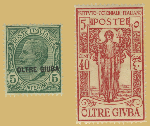
Examples from Oltre Giuba's first definitive
issue and its only semi-postal issue.
The Italian Colonial Institute semi-postal issue of 1926 features an allegory for "Peace" substituting a spade for a sword.
Bibliography
"Foreign News: Jubaland." Time Magazine. 2 Jun. 1924. Time, Inc. Web. 5 Feb.
2014. http://content.time.com/time/magazine/article/0,9171,718418,00.html.
"Oltre Giuba." Standard Postage Stamp Catalogue. 2005.
Rossiter, Stuart and John Flower. The Stamp Atlas. London: Macdonald, 1986.
Direct comments, questions and corrections to:
stampquestions@hotmail.com
© Grose Educational Media, 2014
|