BackwardVirtual Stamp CollectionForward

Newfoundland

Corrected Map Issue of 1929-1931

One Cent Map
The re-engraved stamp on the right shows the correct locations Cape Norman and Cape Bauld.

On January 3, 1928 Newfoundland issued a set of fifteen pictorial stamps to publicize the dominion. The low value one cent denomination featured a map on which the locations of two lighthouses in the Northwest corner of the island, Cape Bauld and Cape Norman were transposed. Between 1929 and 1931 this stamp and many others in the set were re-engraved. The error was corrected on the re-engraved one cent stamp.

Map of Northeastern Coast of Newfoundland
Detailed map of the area around Cape Norman and Cape Bauld, Newfoundland.


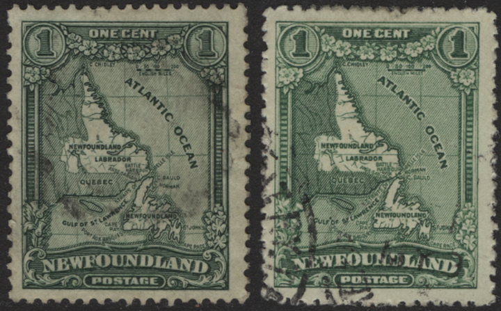
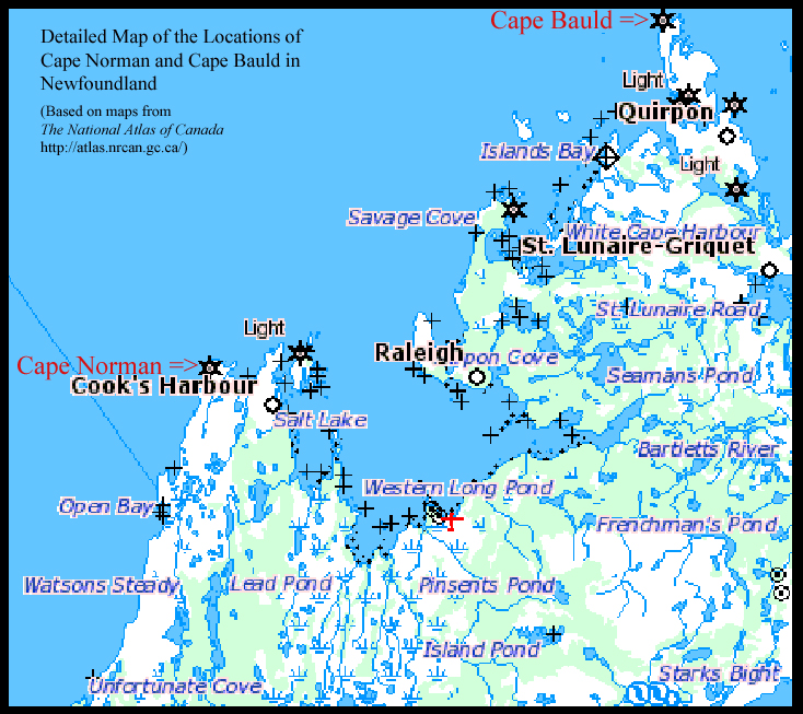
Bibliography

Oliver, Andrew. "Errors of Design: Maps." Gibbons Stamp Monthly. Jan. 2008: 71-74.

"Newfoundland." Standard Postage Stamp Catalogue. 1997.


Direct comments, questions and corrections to:
stampquestions@hotmail.com


Backward

Virtual Stamp Collection Index

Forward


© Grose Educational Media, 2008-2018